| Located next to Mackinac bridge near entrance to fort museum under I-75 | Coordinates Lat N 45:47':16" Lon W 83:43':56" | |
|
||
|
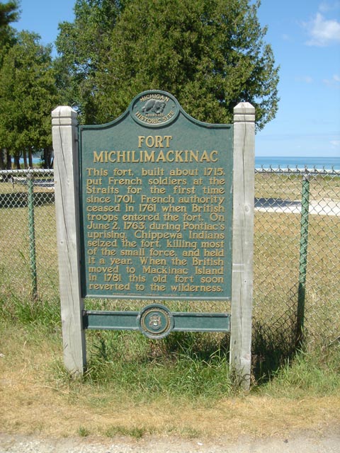
FORT MICHILIMACKINAC This fort, built about 1715, put the French soldiers at the Straits for the first time since 1701. French authority ceased in 1761 when British troops entered the fort. On June 2, 1763, during Pontiac's uprising, Chippewa Indians seized the fort, killing most of the small force, and held it a year. When the British moved to MAckinac Island in 1781 this old fort soon reverted to the wilderness. MICHIGAN HISTORICAL COMMISION REGISTERD SITE NO. 11 MACKINAK ISLAND STATE PARK COMMISION |
|
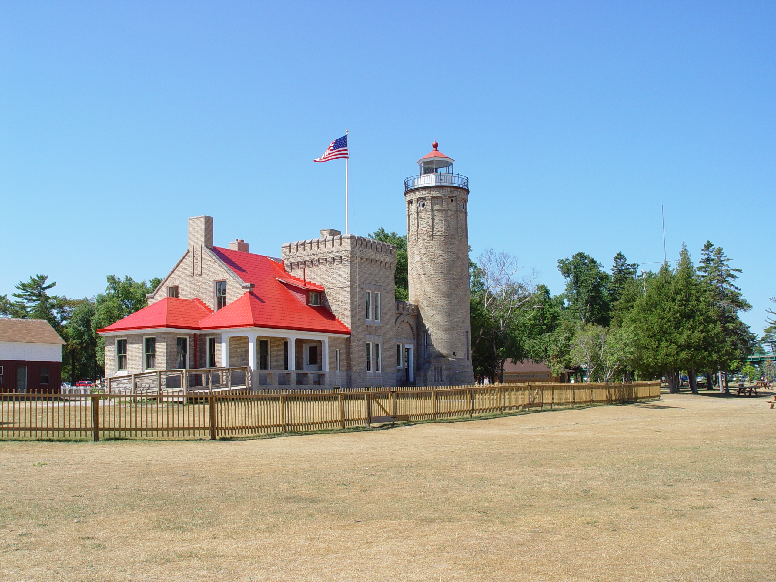 |
The light house located in the park now is open for tours you can get a hi resolution image of the light house by clicking on the picture |
|
|
|
||
| Back to Historical Markers | ||
| Back to USA |