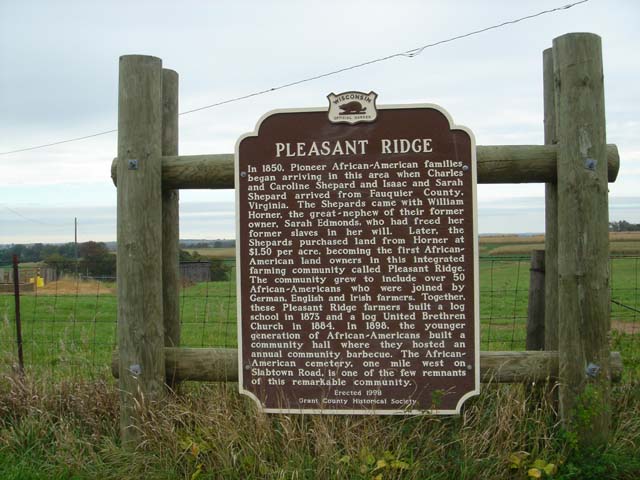
PLEASANT RIDGE
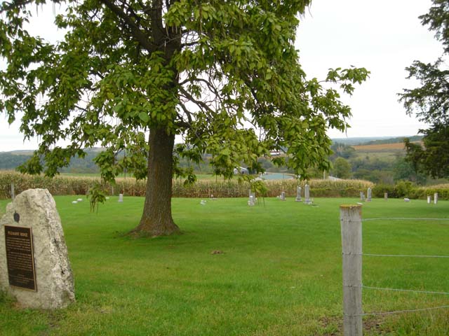
In 1850, Pioneer African~American families began arriving in this area when Charles and Caroline Shepard and Isaac and Sarah Shepard arrived from Fauquier County, Virginia. The Shepards came with William Horner, the great - nephew of their former owner, Sarah Edmonds, who had freed her former slaves in her will. Later, the Shepards purchased land from Horner at $1.50 per acre, becoming the first African~ American land owners in this integrated farming community called Pleasant Ridge. The community grew to include over 50 African-Americans who were joined by German, English and Irish farmers. Together, these Pleasant Ridge farmers built a log school in 1873 and a log United Brethren Church in 1884. In 1898, the younger generation of African-Americans built a community hall where they hosted an an ual community barbecue. The African- American cemetery y, one mile west on, Slabtown Road, is one of the few remnants of this remarkable community.
Erected 1998
Grant Historical Societey |
|
|
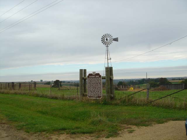
Cemetary is located
Coordinates Lat N 42:49':847" Lon W 90:48':799"
About 1 Mile west of Highway 35/81 on Slabtown Rd |
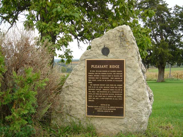
PLEASANT RIDGE
IN 1848, WILLIAM HORNER OF WARREN COUNTY, VIRGINIA AND HIS FORMER SLAVES, THE SHEPARD FAMILY, HITCHED A TEAM OF OXEN TO WAGONS AND VENTURED WEST TO WISCONSIN. THEY ARRIVED AT THIS POINT, LATER TO BE KNOWN AS PLEASANT RIDGE.
THE SHEPARDS BOUGHT LAND FROM MR. HORNER FOR $1.10 AN ACRE, MAKING THEM THE FIRST RECORDED AFRICAN • AMERICAN FAMILY TO LIVE IN THE AREA. THE BEGINNING OF: A COMMUNITY OF OVER 100 FREE OR ESCAPED SLAVES, PLEASANT RIDGE AT ONE POINT HAD A CHURCH AND SCHOOL; NOW THE ONE ACRE CEMETERY IS ALL THAT REMAINS.
ERECTED BY THE
'WISCONSIN SOCIETY DAUGHTERS HE THE AMERICAN REVOLUTION,
STATE REGENT, PHYLLIS BAUNGARTNER
. DEDICATED, AUGUST 28, 1994
|
|