| Located approximately 2 miles south of Dubuque off highway 52 in Mines of Spain state recreational area | Coordinates Lat N 42:28':08" Lon W 90:38':48" | |
 |
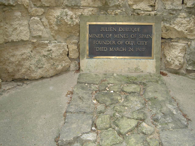
The Grave of Dubuque overlooking the Mississippi river |
|
|
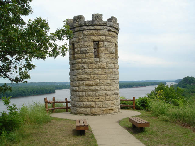
Located inside the Castle structure |
|
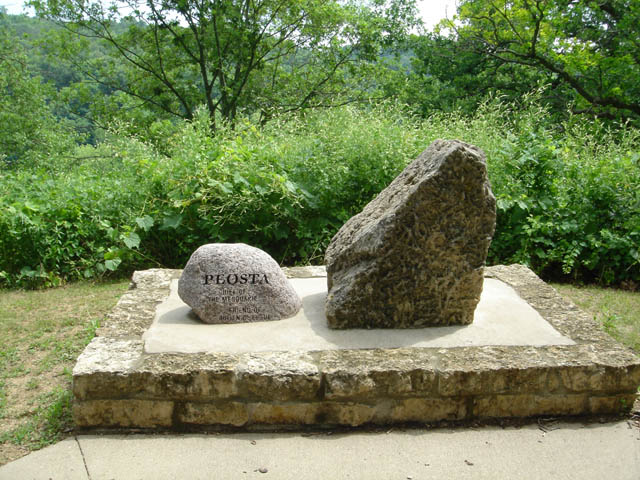 |
PEOSTA CHIEF OF THE MESQUAKIE FRIEND OF DUBUQUE
|
|
 |
HISTORIC DUBUQUE ~~ the Key City of Iowa~~ formed a part of what became the French Louisiana when Joliet and Marquette paddled by in 1673. Perrot taught the Miami Indians ho to mine lead here in 1690. France ceded Louisiana west of the Mississippi to Spain. Frenchmen mined lead here during the American Revolution. The Fox indians granted Dubuque the right to work lead mines in 1788 and this right was confirmed by a Spanish Land Grant in 1796. Dubuque, the first permanent settler in Iowa, died in 1810. His tomb is on a bluff overlooking the Mississippi below Dubuque. Sturdy lead miners drew up the Miner's compact (the first code of laws in Iowa) on this site in 1830. Permanent white settlement began here in 1833 following the withdrawal of the Fox Indians. The first survey of the city limits was made that fall. Dubuque is a city of any firsts~~the first church and the first murder and public hanging(1834), the first newspaper and the first bank (1836), The town incorporated in 1836. Dubuque city and county, had 31,164 inhabitants in 1860. Erected by the State Historical Society of Iowa and the Iowa State Highway Commission 1967
|
|
| Back to Historical Markers | ||
| Back to USA |