| Located in first rest stop north of Mackinac bridge off of I-75 | Coordinates Lat N 45:51':00" Lon W 84:43':20" | |
|
||
|
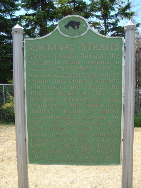
MACKINAC STRAITS Nicolet passed through the Straits in 1634 seeking a route to the Orient. Soon it became a crossroads where Indian missionary, trapper, and the soldier met. From the 1600's through the War of 1812 first Frenchman and Englishman, then the Briton and American fought to control this strategic waterway. In 1679 the Griffin was the first sailing vessel to ply these waters. The railroad reached the Straits in 1882. Until the Mackinac Bridge was opened in 1957, ferries linked the north and the south. MICHIGAN HISTORICAL COMMISION REGISTERD SITE NO. 82
|
|
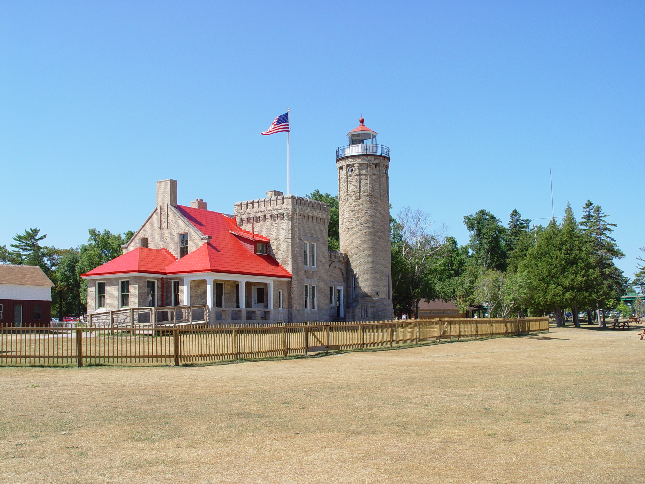 |
The light house located in the park now is open for tours you can get a hi resolution image of the light house by clicking on the picture |
|
|
|
||
| Back to Historical Markers | ||
| Back to USA |